The Sad, the Bad and the Blue (Stain)
Forestry statistics for Libby South Fire Kill Salvage
Sale
(click here to return to the salvage logging page)
by
George Wooten
Field Representative
Kettle Range Conservation Group
February, 2002
General:
-
The size of the proposed cut is 418 acres.
-
The site index (from the Okanogan County Soil Survey) is 70. This agrees
with Williams and Lillybridge (Forested Plant Associations of the Okanogan
National
Forest, 1982) who calculate a site index of 77 and 39, respectively,
for the fir and ponderosa pine in a Douglas fir / pinegrass stand, such
as those in this timber sale.
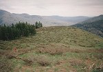
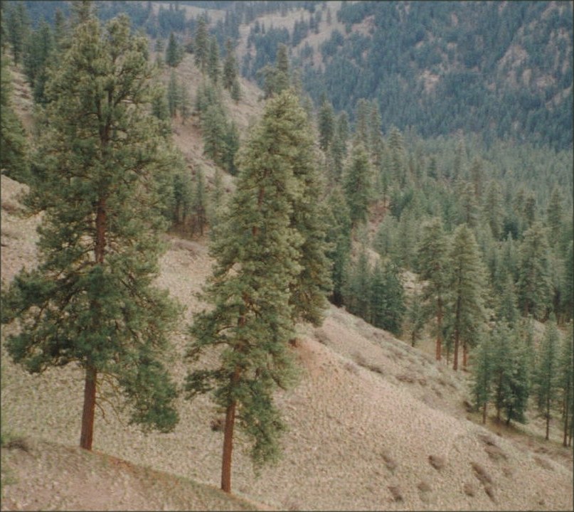
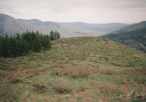
Pre-fire conditions
A team of botanists from the Trust for Habitat Conservation did a botanical
survey of Grouse Hollow before the fire. Grouse Hollow is about a mile
south of the Libby South Sale, and has the same habitats, althought they
are predominantly south facing. Grouse Hollow also burned during the fire
- twice (including an earlier spring burn). The following 3 photographs
of Grouse Hollow are representative of the conditions at Libby South.
Ancient pines occupy the openings.
 (click to enlarge)
Slopes are steep and easily damaged.
 (click to enlarge)
Bitterbrush - arrowleaf balsamroot - bluebunch wheatgrass (Purshia tridentata
/ Balsamorhiza sagitata - Agropyron spicatum) is the dominant vegetation
type, here seen in April of 1997 of before the plants gained height.
 (click to enlarge)
The vegetation at Grouse Hollow included the following (*'d items are
introduced species)
Trees:
Pseudotsuga menziesii
Pinus ponderosa
Shrubs:
Purshia tridentata
Prunus virginiana
Forbs:
Balsamorhiza sagitata, Dodecatheon pulchellum, Mertensia longiflora,
Lithophrogma bulbifera, Lomatium ambiguum, Erigeron linearis, Collomia
tenella, Microsteris gracilis, Collinsia parviflora, *Centaurea diffusa,
Melica bulbosa, Calochortus macrocarpus, Calochortus lyallii, Allium acuminatum,
Artemisia dracunculus, Achillea millefolium, Hydrophyllum capitatum, Draba
verna, Dntennaria dimorpha, Delphinium nuttallianum, Fritillaria pudica,
Senecio integerrimus.
Graminoids:
Agropyron spicatum, Festuca idahoensis, Poa secunda,
Because of steep cliffs along its eastern edge, Grouse Hollow was never
heavily grazed. Grouse Hollow was perhaps the highest quality shrub-steppe
habitat ever visited by the botanists on the team. The diffuse knapweed
was thick on Gold Creek below, but practically nonexistent in the upper
part of the valley.
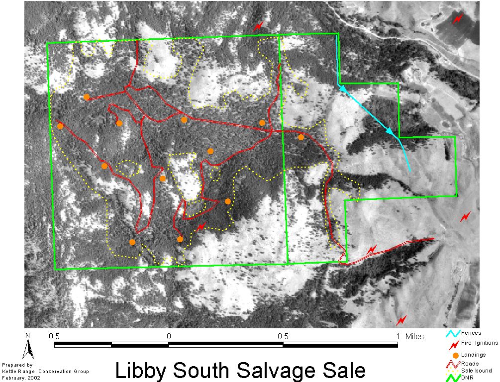
Unmodified sale particulars:
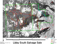 (Click for an aerial view depicting the proposed Libby South timber sale
layout).
(Click for an aerial view depicting the proposed Libby South timber sale
layout).
-
The original volume was 2.931 mmbf original with negligible leave trees,
i.e., it is a liquidation.
-
At 4,000 bf / truckload, this would be equivalent of 2,931,000 / 4,000
= 732 truckloads.
-
The unmodified volume would be 2.931 mmbf / 12 =244,250 cf.
-
Adjusting for kerf and slab of 4.75 / 12 (39.58%), the cubic volume converts
to 244,250 / 0.3958 = 617,105 bf.
-
For Libby S. this is 617,105 bf / 418 ac = 1,476 cf per acre. Over a 100
year rotation which is the nominal rotation period for this Douglas fir
of site index 70, this equates to 14.76 cf / ac / yr.
The
Okanogan National Forest, and most of the USDA, classify land producing
less than 20 cubic feet per year as non-commercial, i.e., unable to pay
for the cost of logging and fire-fighting. Yield tables published by USDA
Tech. Bulletin 201 were also consulted. No yields are given for site indices
less than 80, again, because this low of a site index is considered off-base
to timber harvest. However, if the site index was 80, the yield at 100
years of 12-plus fir trees is given as 2,410 cf, or about 24 cf / ac /
yr.
If timber
mining were legal, yield tables based on actual productivity for mixed
conifer for a Douglas fir site index of 71, are suggested as being somewhere
near 29 cf / ac / yr. by Randall OToole of Cascade Holistic Economic Consultants,
in Review of the Okanogan National Forest Plan, Nov. 1982, which
is based on moderate thinning to maintain the stand at a higher yield,
albeit at an economic cost which can seldom be justified on noncommercial
forests. For comparison,
According
to the State of Washington Joint Legislative Audit and Review Committees
Report 96-5, Forest Board Transfer Lands, in 1993, Washington
state forest lands generated $69 per acre, the highest of any state. In
1995, DNR spent approximately $30 per acre to manage around 600,000 acres
of forest board lands. In this document, DNR indicates that the state-wide
yield per acre at harvest for a 100-year rotation for is 74,950 bf (p.
43), or about 749.5 bf / ac / yr. With a slab & kerf factor of 0.5,
this works out to 749.5 / (12 * 0.5) = 125 cf / ac / yr. Thus, compared
to the state average, the yield per acre at Libby S. is 14.75 / 125 = a
return to the trust of only 12% of the state average, or about 6% of an
acre of commercial west-side forest like that of Weyerhauser.
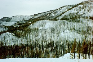
Libby South
100-year old stick sale:
View from
north edge of sale toward south edge on ridge at center of photo:
Question:
Why
is Libby S. so low in timber productivity (12% of the state average), when
it should be higher to account for the standing old growth pine on the
site?
Answer:
Because
this area receives only 15 inches of rain a year, trees naturally grow
about one-tenth of the rate of a productive west-side forest. It took over
200 years for some of the large ponderosas on this site to reach their
present size. In addition, most of the trees are overstocked and unhealthy,
because of a lack of thinning, whether silvicultural, or natural (as would
normally happen during historical underburns in the original stand).
Modified Libby S. sale particulars:
-
The modified volume of the Libby S. sale is 2.3 mmbf (78.5%) after modifying
to leave 3 tpa plus 2 largest pine per acre, or about 0.6 mmbf less.
-
This works out to 2,300,000 / 418 = 5.5 mbf / acre.
-
The stumpage value of the 2.3 mmbf modified sale is $311,000, or $744 per
acre, to which an additional $35,000 must be paid for road maintenance.
This can be converted to volume: $744 / 5.5 mbf = $135 / mbf. For comparison,
the normal stumpage value for area 7 distance haul zone 2, the stumpage
is $276 / mbf for Douglas-fir of quality no. 1, or ponderosa pine of quality
2.
-
This means that an acre of Libby South ground is returning less than
3% to the trust compared to that of an acre of commercial timber land.
-
At 4,000 bf / truckload, the modified volume would be 2,300,000 mmbf /
4,000 = 575 truckloads.
-
These 575 truckloads of timber would cost the timber company $311,000 +
$35,000 road maintenance deposit, plus the cost of building 2.77 miles
of new road plus 17 new culverts. According to Jack Phelps, Alaska Forest
Association, Information Services, Forest roads program not a subsidy
to industry, March, 1997 (http://www.akforest.org/roads.htm)
road construction costs under the Purchaser Road Credit program averaged
$25,900 per mile, compared with a cost of $60,200 per mile when built by
general contractors with appropriated federal funds. Since the road at
Libby South is to be built by the logging company, that is a guarantee
that the lowest figure is more realistic, in which case road costs for
2.77 miles at Libby S. are estimated at 2.77 * $25,900 = $71,743.
-
Therefore the estimated cost per truckload is thus $311,000 + $35,000 +
$71,743 / 575 = 417,743 / 575 = $727 per load, which is still low, considering
miscellaneous administrative, bond, insurance, etc, wasnt counted. And
remember, this timber is damaged, riddled with bugs that the DNR entomologist
aid would require very careful marketing to sell.
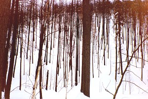
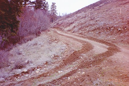
Photo
of scorched, overstocked, trees at Libby S:
The question is, why is the DNR burning public
money to liquidate this timber?
Answer:
It is obvious from the squawking noises in the state capitol calling for
an accelerated rate of liquidation of trust assets, and transfer
of timber assets to county control, that the DNR is being pressured
to act in an unsound manner uninformed politicians who do not understand
the ecology of the ponderosa pine / sagebrush steppe ecosystem.
Photo
of where the fire began and how - the patch of Noxious Weeds
where
DNR drove its dilapidated rig:
Close up of a future debris flow site
-
weeds and erosion where the fire started.
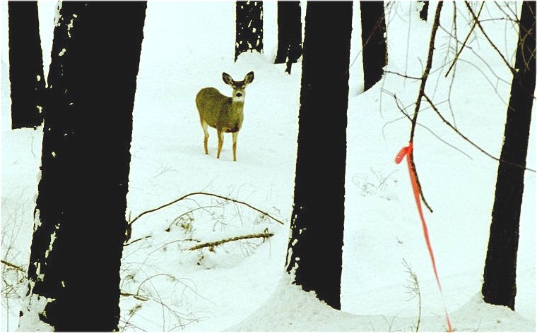
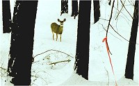
Bambi indicates the location of a proposed road in
logging
unit, in a protected canyon where he lives
with
friends owl, bear and woody woodpecker.
 click to enlarge
Vegetation at Libby South:
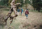
On November 27, a group of citizens visited portions of the Libby South
proposed Sale area. Vegetation was recorded at the site where the fire
began, in a ravine with open shrub-steppe on one side and riparian forest
on the other. observed was heavily infested with noxious weeds. A partial
vegetation list follows (*'d items are introduced species):
*Centaurea diffusa, *Agropyron repens, *Cynoglossum officinale, Chaenactis
nauseosus, *Sisymbrium loeselii, Rhus glabra, *Verbascum thapsus, *Cirsium
vulgare, *Poa pratensis, Phalaris arundinacea, *Nepeta cataria, *Pyrus
malus, *Poa bulbosa, Eriogonum niveum, Balsamorhiza sagittata, Purshia
tridentata, *Bromus tectorum (80% cover in openings), Populus tremuloides,
Alnus incana, Sambucus cerulea, Symphoricarpos albus, Betula occidentlis,
Clematis ligusticifolia, Pinus ponderosa, Pseudotsuga menziesii.
It is noteworthy that in comparison with Grouse Hollow, this area has
11 non-native species compared to only 1 at Grouse Hollow. This is most
likely due to livestock, although Grouse Hollow is completely roadless
and has never been logged, so these other forms of disturbance may have
brought in some of the invasive species.
Definitions:
ac,
acre 43,560 sq. ft. or 0.405 hectare
BAF
basal area factor; used to convert variable plot stem numbers to basal
area; generally this should be 5 8 trees per sample point.
bf
- board feet.
cf
cubic feet
cubic
volume (of trees) 1 cubic foot = 12 board feet X fraction of usable wood.
The fraction of usable wood is the ratio of usable board ft per cubic ft
/ 12. the average ratio on the ONF, for trees of 13.75 dia, the ratio
is 4.50 4.8 (.375 0.40).
CMAI
culmination of mean annual incremental growth of a tree.
dbh,
diameter diameter at breast height of a tree, given in inches.
ha.
hectare
MAI
mean annual increment; average annual growth of a tree, usually given
in cf / ac / yr
mbf
thousand board feet
mmbf
million board feet
truckload
29 tons or up to 4,000 board feet depending on defect
non-commercial
land any site not capable of producing 20 cubic feet per acre per year
(Okanogan NF).
kerf
wood volume lost in processing as sawdust.
slab
- wood volume lost in processing as round edges which do not contribute
to lumber production.
productivity
the annual increase in stand volume, usually given in cubic feet per
acre per year.
SDI
Stand Density Index; the number of trees per acre that a stand could
be expected to have if its quadratic mean diameter were 10 inches. For
the Okanogan National Forest, the SDI for Douglas fir or ponderosa pine
is about 226 and 160, respectively
SEV
(soil expectation value land rent; bare land value; the sum of all the
costs of managing an acre of bare land, discounted to the present, subtracted
from all the benefits, discounted to the present.
Site
index height in feet of a tree at a given age, usually 100 or 50 years.
stand
diameter - average diameter of a tree of mean basal area in a stand.
tpa
trees per acre.
yield
MAI
yr
- year
Return
to the Salvage Information Page
Return to Kettle
Range Conservation Group
 (click to enlarge)
 (click to enlarge)
 (click to enlarge)
 (Click for an aerial view depicting the proposed Libby South timber sale
layout).
(Click for an aerial view depicting the proposed Libby South timber sale
layout).